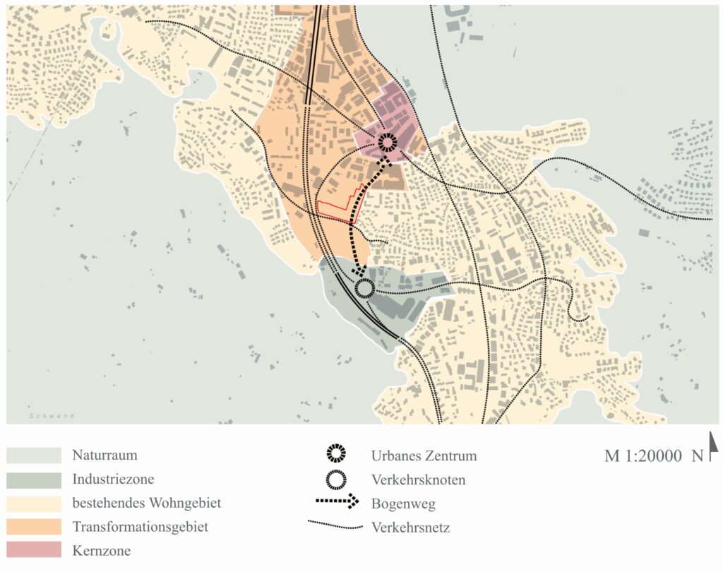
The Grabenhof area is located within a rapidly transforming context, at the boundary between the municipalities of Kriens and Horw, within the sphere of influence of the city of Lucerne. Over the past two decades, these territories have undergone intense urban development, progressively reshaping the landscape. The name “Grabenhof,” literally meaning “farmstead by the ditch,” reflects its topographical origin: an area defined by a natural trench, such as the Schlimbach stream, once used as agricultural land and later transformed into allotment gardens. Today, this ongoing evolution opens the way for a new identity for the site.
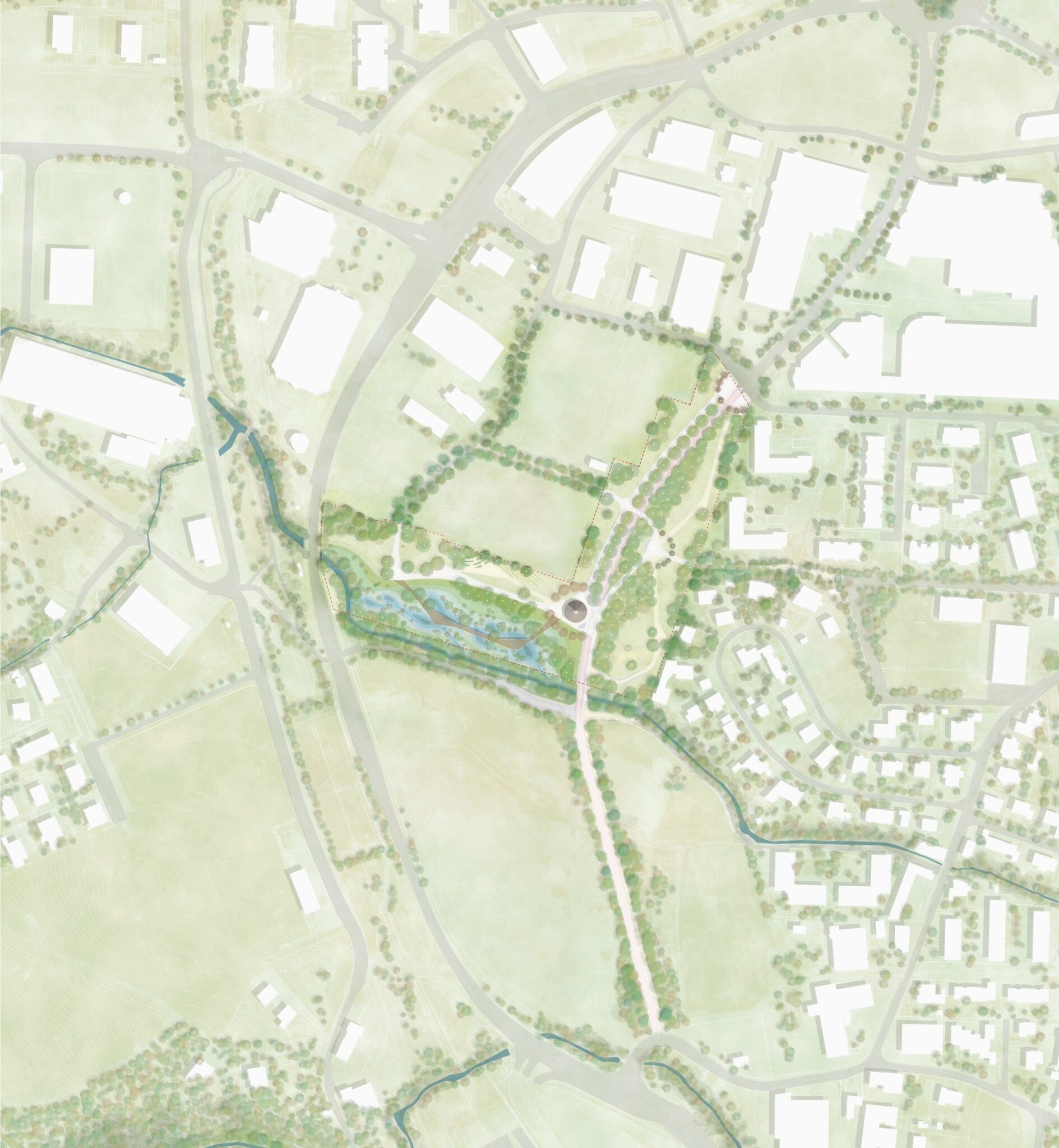
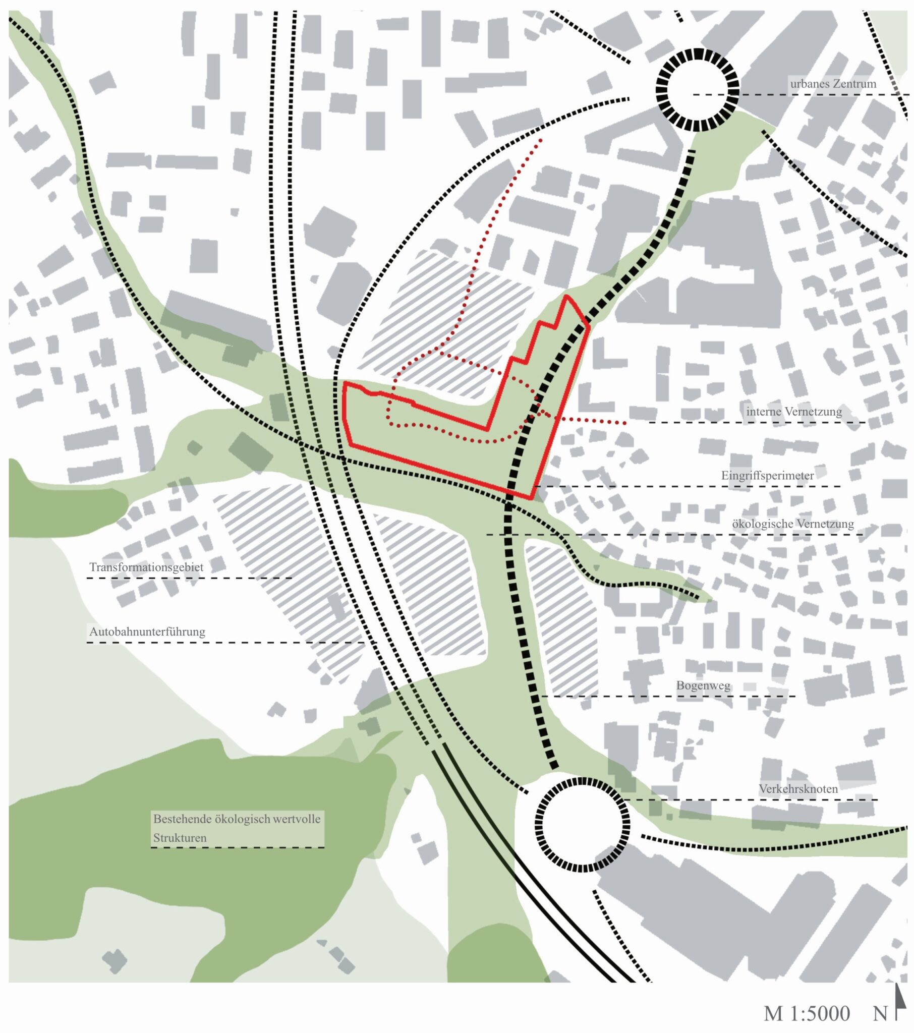
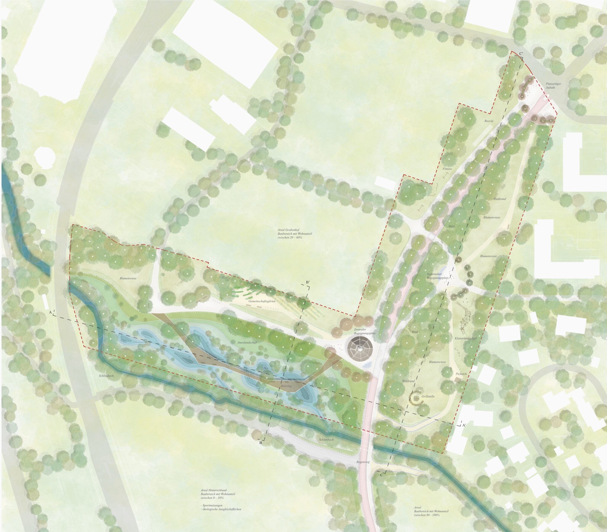
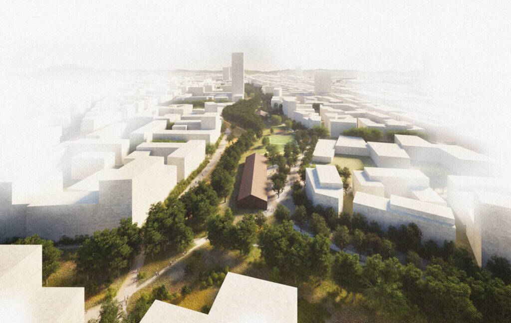
Situated between major urban development areas, Grabenhof is set to become a strategically important open space for the community. Located along the Bogenweg axis, between the Pilatus Arena and the Hinterschlund district, the future park will play a central role in leisure and everyday life. At present, however, the area appears isolated and fragmented: the introverted structure of fenced garden plots, the presence of the stream with its dense vegetation, the lack of effective connections to the east and south, and the infrastructure of Ringstrasse all contribute to a strong spatial discontinuity. The project addresses these issues directly, transforming the site into an open, accessible, and shared space, while also enhancing its privileged landscape position, with views toward the Alpine arc.
Concept
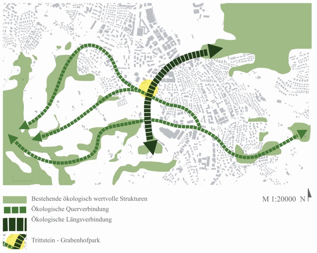
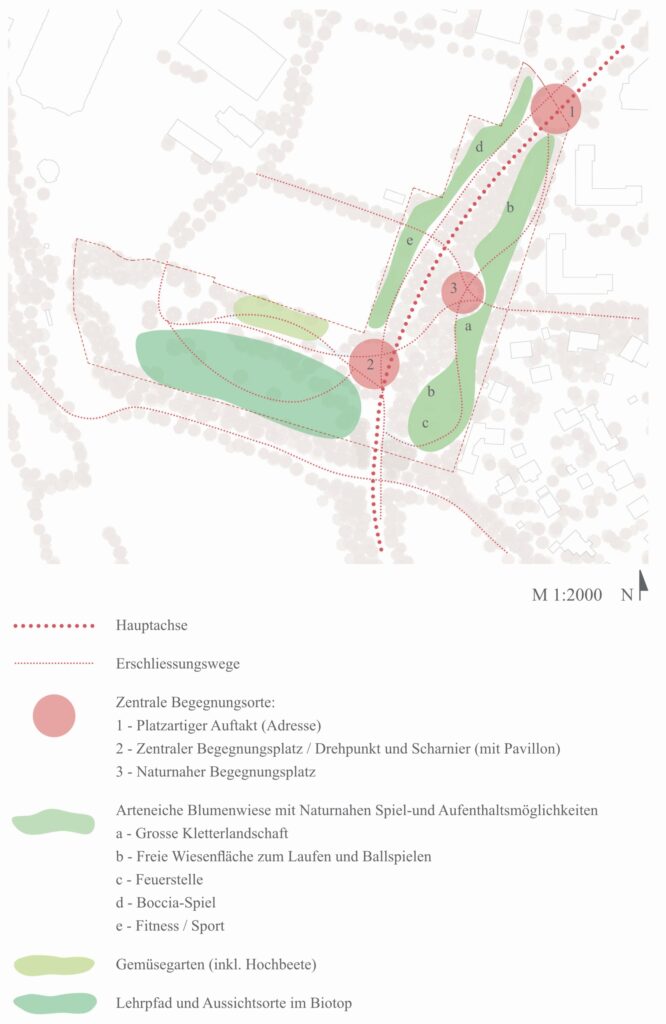
From an ecological perspective, Grabenhof represents a key node within the local network of natural spaces. Despite current limitations, the Schlimbach stream corridor holds significant potential for regeneration. The project aims to strengthen connections between various natural areas—from the forests of Bireggwald to the Chrummbach and the Schattenberg—creating a continuous system of green spaces that supports biodiversity and reduces ecological fragmentation. In this sense, the park acts as a connector within a broader environmental network.
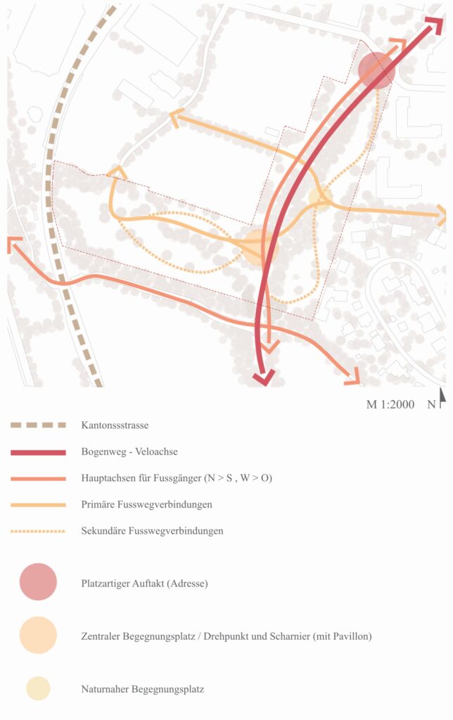
At the same time, great importance is given to slow mobility and to linking surrounding neighborhoods with the centers of Kriens and Horw. The Bogenweg becomes the primary cycling axis, complemented by an integrated network of paths that ensures safe and accessible connections for pedestrians as well. Circulation flows are clearly differentiated, with the introduction of a dedicated promenade that enhances both the quality and safety of movement within the park.
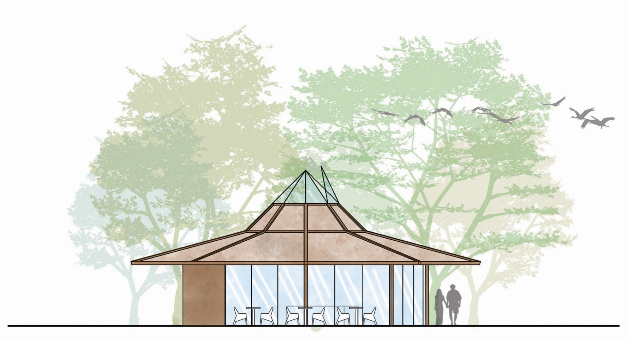
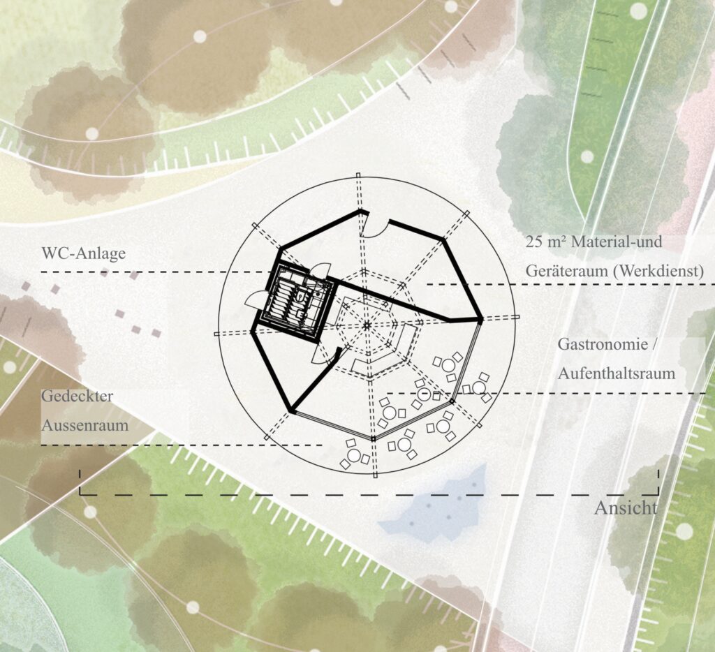
At the heart of the new park, a pavilion is introduced as a social hub and landmark element. In addition to accommodating essential facilities, storage spaces, and restrooms, the pavilion provides a flexible meeting place that can also function as a small café or a venue for community and associative activities, encouraging a wide range of park-related initiatives. The pavilion reinterprets local construction traditions—such as timber frame structures—through a compact and geometric form that integrates harmoniously into the park design. Large glazed surfaces ensure visual continuity between interior and exterior, while the roof, with generous overhangs and an operable central skylight, provides climatic comfort, natural lighting, and ventilation, contributing to a lightweight, efficient architecture closely connected to its context.
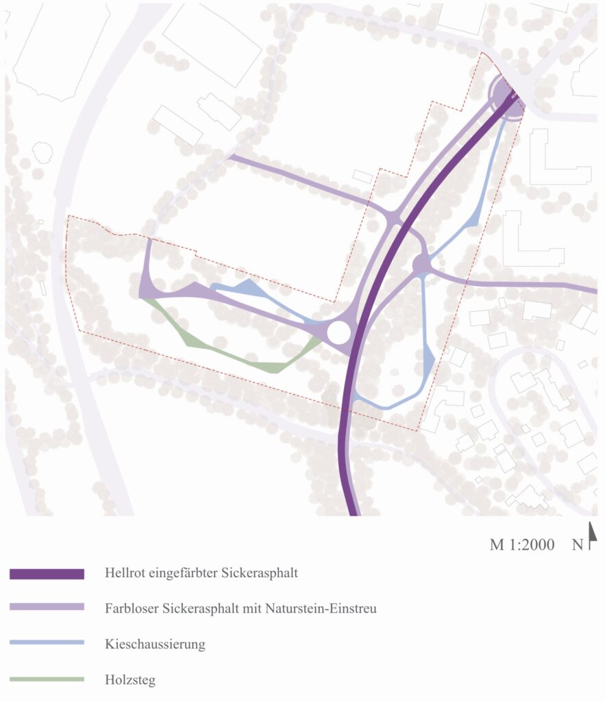
Path materials are selected to ensure permeability, accessibility, and landscape integration: permeable asphalt is used for primary routes, while more natural surfaces define secondary paths. Elevated structures combine metal and treated wood. Overall, the project results in a coherent, sustainable, and inclusive park, capable of combining ecological quality, social value, and a strong landscape identity.
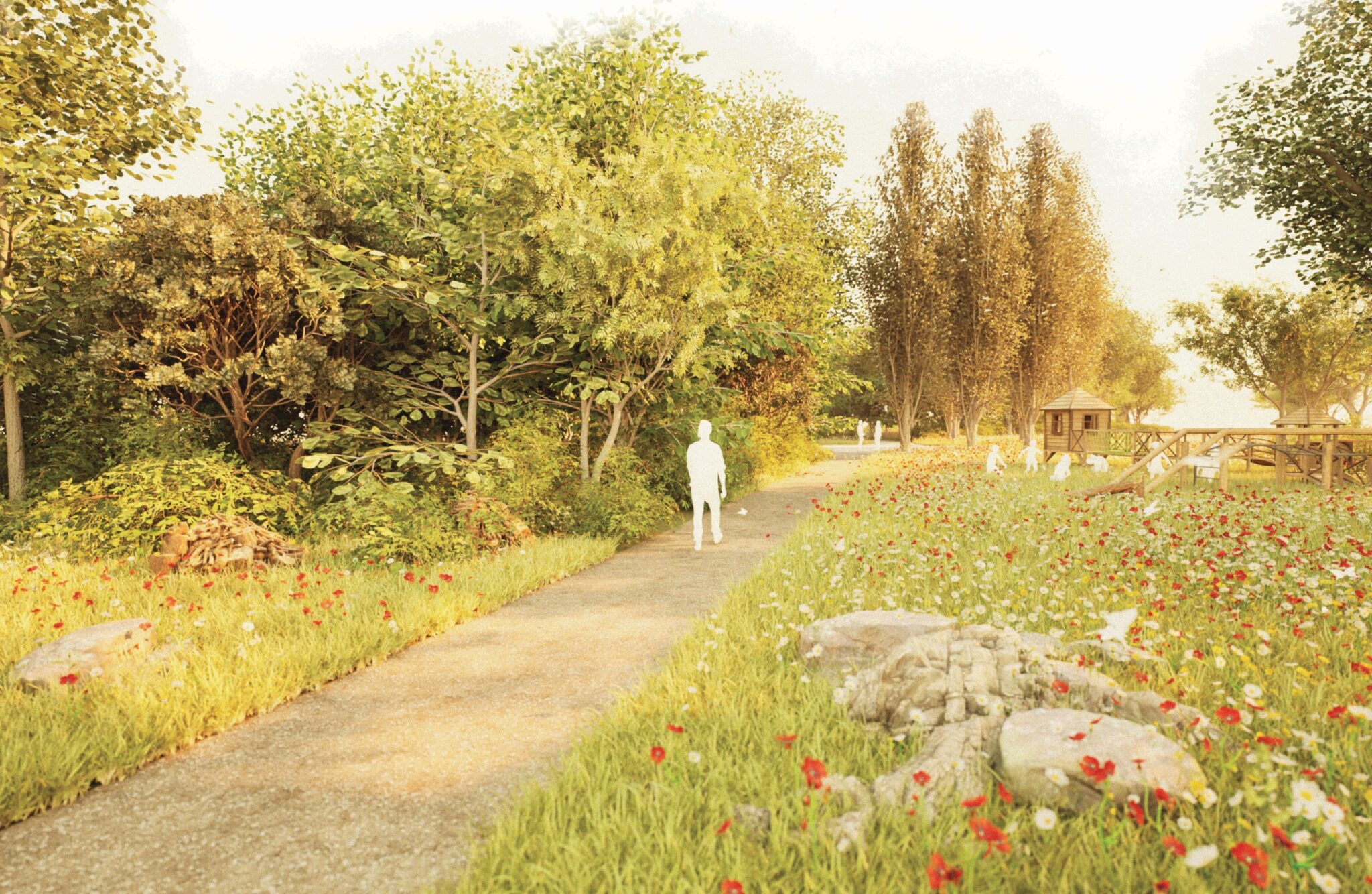
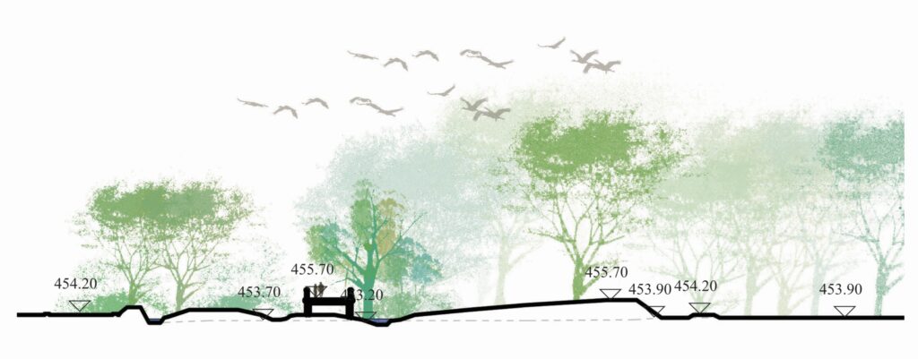
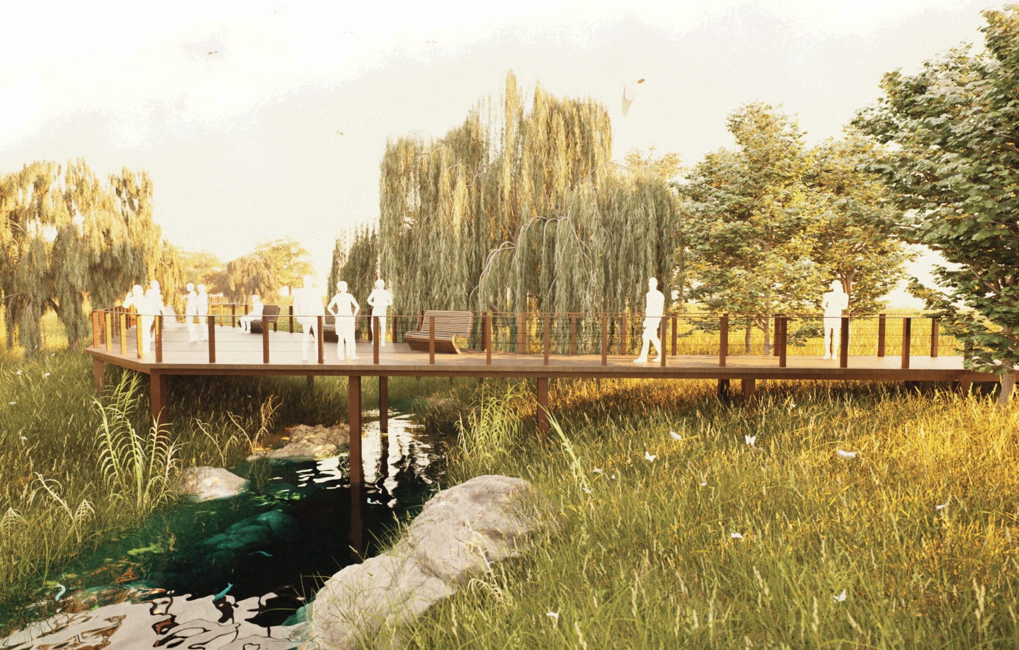
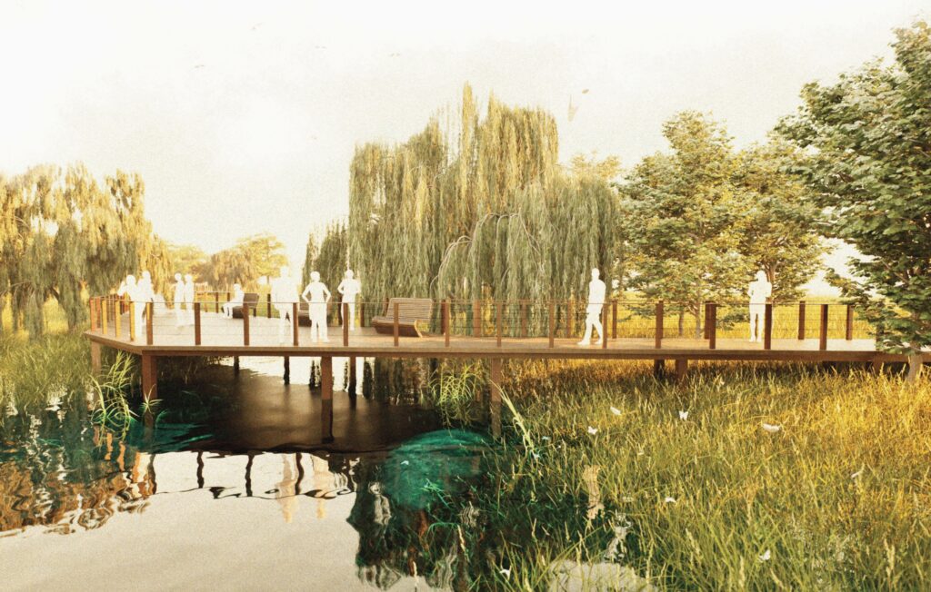
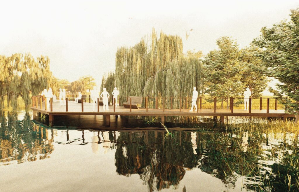
The landscape design emphasizes a natural and dynamic character: expansive green areas, flowering meadows, and spontaneously evolving vegetation define an environment oriented toward contact with nature rather than intensive sports use. Certain open spaces serve as areas for rest and contemplation, while prominent trees arranged in circular formations become identity-defining elements and orientation points. The Schlimbach stream is made accessible through elevated walkways, allowing public use without compromising sensitive habitats.
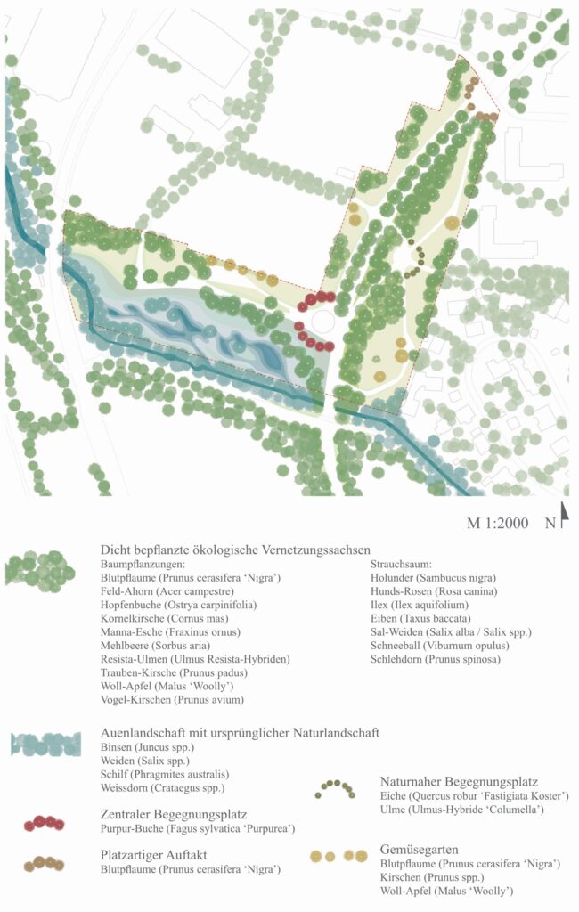
The planting strategy is based on native, resilient, and climate-adapted species, organized in a layered structure including trees, shrubs, and herbaceous plants, promoting the creation of diverse habitats. Particular attention is also given to the memory of the site, evoked through the use of species associated with traditional orchards.